Ribbons of Color
- 3mediaweb
Looking for a unique way to experience North Central Massachusetts’ world-class fall foliage? Here’s a tip: Check out the region’s quiet-water paddling destinations.
Autumn is a great time to explore these waterways: You’ll encounter far fewer people and biting insects than during the summer, river currents are usually gentle, and temperatures are generally pleasant. In addition to the bright colors, keep an eye out for moose, wood ducks, and other wildlife, which are often active this time of year. One note of caution is in order, though. Fallen trees, beaver dams, and exposed logs and rocks may partially or completely block rivers, so you may have to portage around one of these obstructions. The views, however, are well worth the effort.
Here are a few suggestions for stunning foliage paddles throughout the region:
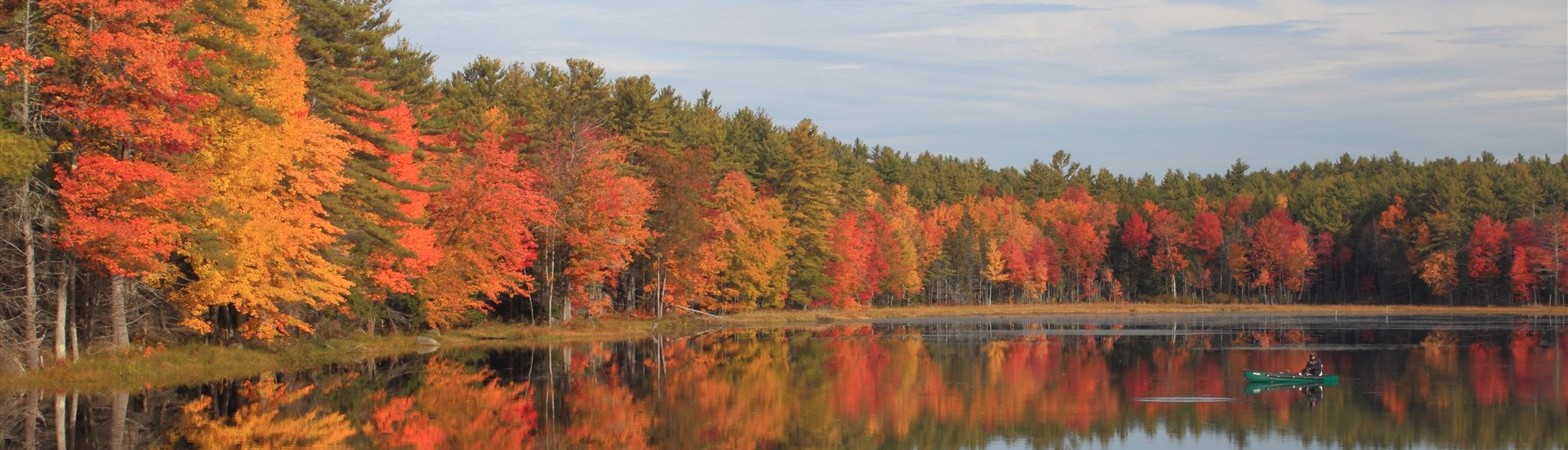
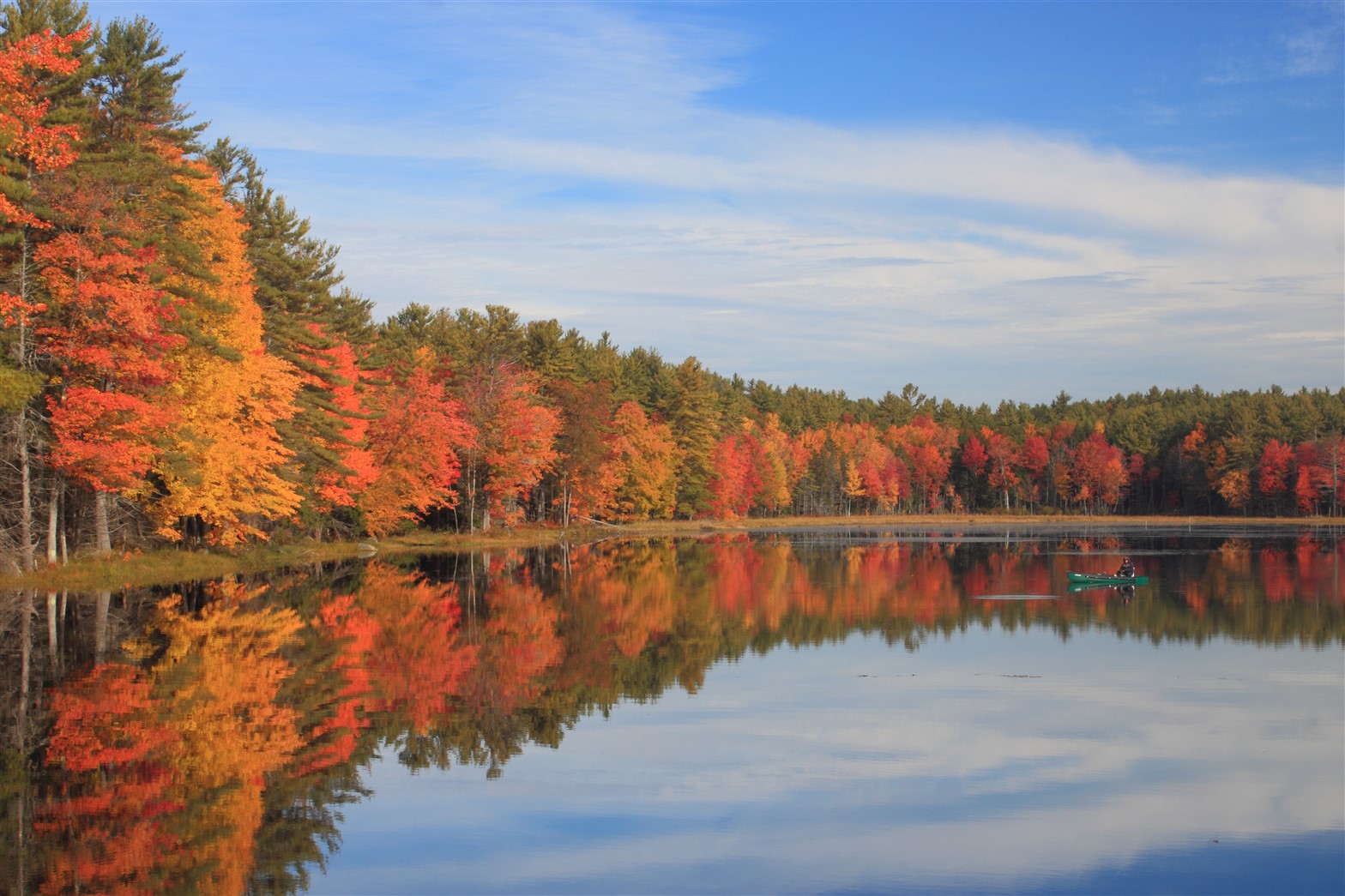 The Tully Lake flood-control area, on the Tully River East Branch in Royalston, is one of the region’s most scenic paddling destinations. The segment from Doane Hill Road to Long Pond (roughly two miles one-way) passes red maple groves with vibrant foliage in early autumn. Colors peak on the valley slopes in mid-October.
Tully Lake offers 84 acres of coves, islands, and undeveloped shoreline to explore. Launches are available at Doane Hill Road (across from Tully Lake Campground) and Tully Lake Recreation Area on Route 32. The campground, featuring waterfront tent sites and canoe and kayak rentals, is open weekends from mid-September to the third week of October.
Lake Dennison Recreation Area in Winchendon, part of a large expanse of protected land along the Millers and Otter rivers, offers several paddling options. A loop around 84-acre Lake Dennison (roughly 1.7 miles) can be completed in an hour or so. A boat ramp is located on the west shore, and paddlers can also put in from picnic areas and the beach near the main entrance.
Beaver Pond, a shallow 38-acre pond in Royalston, is another favored destination for paddlers, anglers, and wildlife watchers. A cartop launch and picnic area are on Swamp Road near Birch Hill Dam’s spillway. The most direct access is from the River Road entrance off Route 68 in South Royalston.
The Millers River meanders past oxbow bends and wetlands upstream from Birch Hill Dam. The river is usually easy to navigate in late summer and autumn, though seasonal beaver dams and fallen logs can be occasional impediments. A put-in is located at the bridge on New Boston Road (a dirt road open seasonally to vehicles), 0.3 miles west of Lake Dennison. Another launch is roughly 2.5 miles downstream on River Road near Birch Hill Dam.
Connor Pond lies in the heart of a large conservation area on the Swift River East Branch in Petersham. It’s a nice place to enjoy an easy paddle with views of foliage on the shores and valley hills. The entrance is on Route 122, 1.2 miles north of the Barre town line; follow the dirt road along the shore to the fishermen’s access.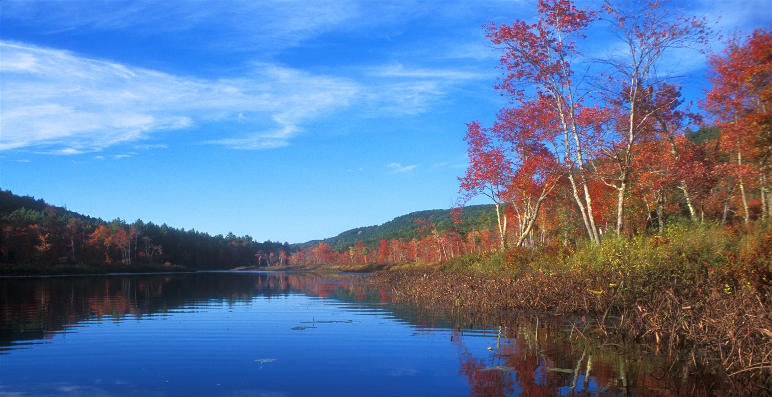
With it remote, largely undeveloped setting and boggy vegetation, Hubbardston’s Moosehorn Pond offers the feel of a north woods wetland.
This 62-acre shallow pond offers easy paddling along 1.5 miles of shoreline. The bog mat and red maples at the north end are colorful in early autumn, and the golden needles of tamarack trees add a last shot of color before winter sets in. The public ramp is reached via a dirt access road off Old Princeton Road (East Hubbardston Road), just east of the intersection with Simonds Hill Road.
The 61-acre Paradise Pond, built in the 19th century as part of a saw mill on Keyes Brook, is the largest of several scenic ponds in Leominster State Forest. Although Route 31 runs along its west side, the rest of the shoreline, nestled at the base of Wolf Den Hill, is pristine and undeveloped. There are several roadside access points along Route 31.
The largely undeveloped Squannacook River, a tributary of the Nashua River, offers easy paddling through a state wildlife area. The put-in on Townsend Road in West Groton (1.1 miles from the junction with Route 225) is at a shallow wetland
behind an old industrial dam. As you head upstream the river narrows and winds past deciduous woods and ferns. There are also many opportunities to watch for wildlife including resident beavers, ducks, and wading birds.
The Nashua River flows north through a corridor of protected land in Harvard, Bolton, and Shirley. From the boat ramp at the end of Still River Depot Road off Route 110 in Harvard, head downstream through Oxbow National Wildlife Refuge or south (upstream) towards Bolton Flats Wildlife Management Area. Uncommon silver maple trees grow along the riverbank.
So climb out of the car. Get off the beaten path. Enjoy the colors of autumn from a new vantage point — and immerse yourself in the beauty of nature, in the countryside of North Central Massachusetts. §
Resources
Not familiar with the rivers, streams and ponds of the region? Fortunately, there are plenty of maps and guides available to help you find your way around.
Here are a few to check out:
• For 50 years, the Nashua River Watershed Association, a non-profit organization, has worked to protect the natural resources of the within the area around the Nashua River and its tributaries, the Nissitissit, Squannacook, North Nashua, and Stillwater Rivers. The NRWA offers a Canoe and Kayak Guide that includes maps of those rivers and information on put ins, hazards, and what you might see during your paddle. Visit nashuariverwatershed.org.
• Nashoba Paddler, located on West Main Street in Groton, offers canoe and kayak rentals, and conducts public and private tours of the Nashua or Squannacook Rivers from May through October, including some fall foliage paddles. Learn more at nashobapaddler.com.
• The Massachusetts Department of Conservation and Recreation has a wealth of information about state parks and the activities — including canoeing and boating — available. You can find a map with directions and details about state facilities at .mass.gov/canoeing-and-kayaking-in-massachusetts.
Story & Photography by: John Burk